Gold Coast Hinterland, Queensland, Australia


Australia's Gold Coast is well known for its tens of kilometers of golden beach and amazing surf spots, but the Gold Coast is actually a holiday paradise. Featuring beautiful mountains, wonderful beaches, great food spots and almost the perfect climate all year round.
Our road trip starts by the water at Surfers Paradise, where you can find any number of restaurants and cafes offering breakfast by the beach. My favourite spot for breakfast is Sandbar on the Esplanade. After breakfast we head down the coast to Burleigh Heads and suggest a walk out along the point into the Burleigh Heads National Park where you will get some great views of the coast and the city. We then drive down the coast a bit further to Point Danger, at Coolangatta. If you are visiting during autumn or early spring watch out for Humpback Whales breaching just off the point. Point Danger gives you great views of the world famous Snapper Rocks surf break.
Leaving Point Danger we head up into the Gold Coast Hinterland via the beautiful Currumbin Valley. Heading into the Currumbin Valley is a little like entering an Aladdin's Cave of adventure. The drive takes you through another world along Currumbin Creek Road and winding your way up Tomewin Mountain Road to Tomewin Mountain. At 457 metres high it offers a great vantage point over the entire valley as well as north to Mount Tallebudgera and west across the World Heritage-listed Rainforest mountains of Cougal and Springbrook. There's also plenty of galleries teaming with pottery and arts and crafts in which if, you look carefully, your own genie may await.
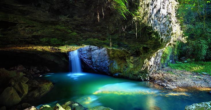
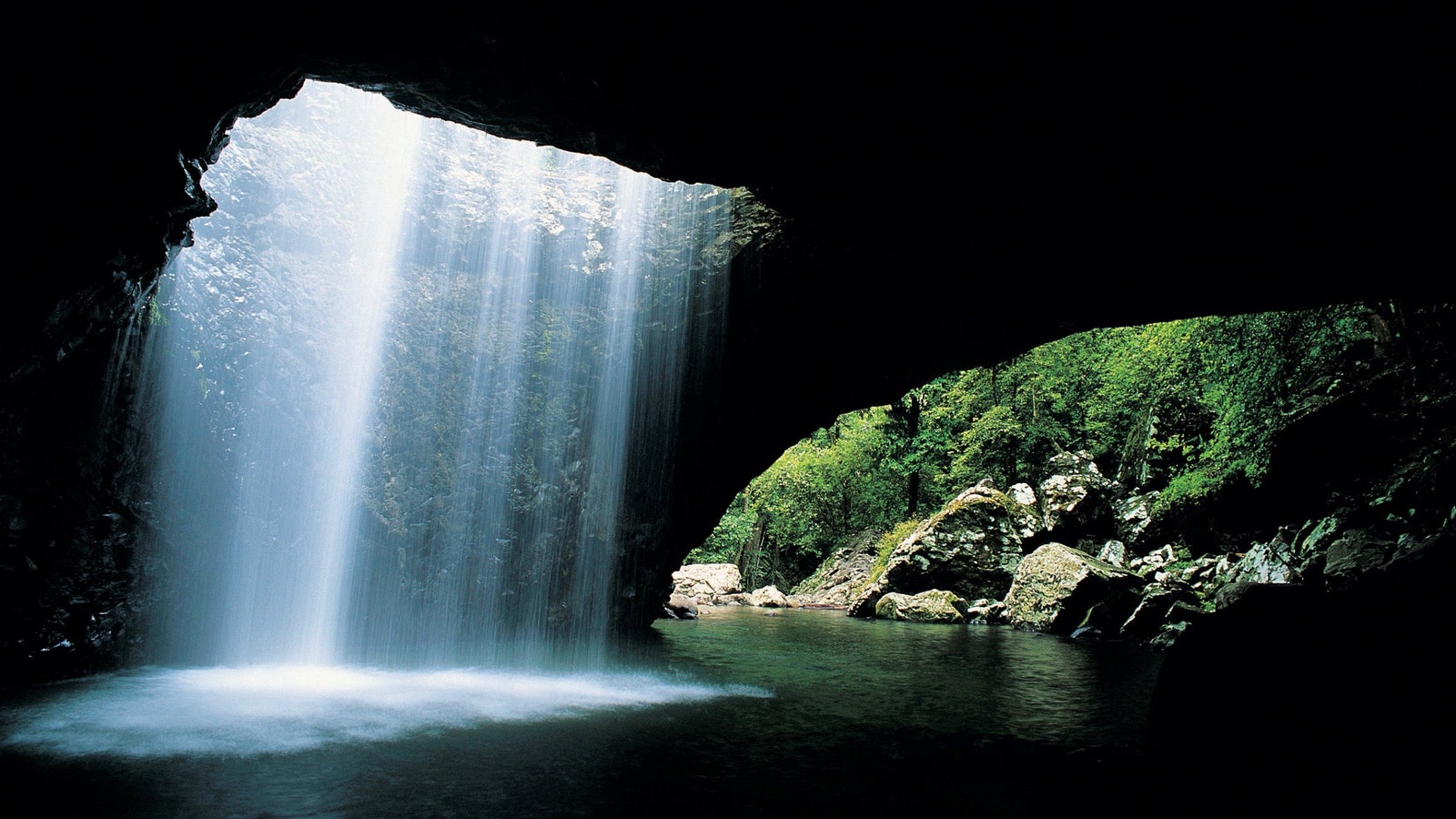
We then drop down into New South Wales for a short while and wind through the farm lands new Murwillumbah before heading back up the escarpment and onto the Lamington Plateau and make our way to the beautiful Natural Bridge (official) or Natural Arch (locals) National Park with its stunning waterfall. Access to the waterfall is via a short walk through the rainforest. By the way if you come back to the waterfall at night Glow Worms glitter on the ceiling of the cave. On leaving Natural Bridge we head towards the Tamborine Mountains, for those feeling peckish you will find the Natural Arch Cafe Restaurant, also known as the Two Pines Cafe, one of the oldest and most historic cafés in the Numinbah Valley just along the road a bit.
The Tamborine Mountains Tamborine Mountain is the third oldest national park on the planet and offer visitors a range of things to experience. Beautiful natural features like Curtis Falls, Cedar Creek Falls, Tamborine Forest Skywalk and Tamborine Mountain Botanical Gardens and Rainforest walk, the national park includes 12 other walking tracks. For a change of pace, enjoy several wineries, a brewery and even a distillery up on the mountain, which is perfectly punctuated with award-winning restaurants, art galleries, sweeping coastal views and that delicious mix of old and new-world charm.
From Tamborine Mountain we head back down onto the coastal plan and to end destination of The Spit. Along the drive you will wind through wonderful valleys and through the waterfront suburbs of Hope Island, Paradise Point and Runaway Bay. Hopefully if we have planned our day well we should arrive at the Spit around sunset or just after. The Spit offers magnificent views of the Gold Coast looking south and is a great place from which to appreciate the lights of Surfers Paradise at night.
Getting there
After visiting Surfers Paradise and having an early breakfast by the beach at one of the many restaurants head south on Gold Coast Hwy/State Route 2 towards Burleigh Heads. Good parking will be on your right near the beach. After a stroll around the Burleigh headland continue south on Gold Coast Hwy/State Route 2 towards Coolangatta.
When you reach the Gold Coast Airport (on your left) the turn off for Coolangatta will be on the right. Use the 2nd from the left lane to continue on Coolangatta Rd keeping right to stay on Coolangatta Rd. Continue onto Tweed St and at the roundabout, take the 2nd exit onto Dutton St, and then at the roundabout, take the 3rd exit onto Lanham St. At the roundabout, take the 1st exit onto Warner St and at the next roundabout, take the 3rd exit onto Griffith St. Go straight through the first roundabout and then take a slight left onto Boundary St and then turn left onto Hill St and continue onto Marine Parade and then onto Tweed Terrace. Turn left and Point Danger will be on the left.
After you have taken in the beautiful sites of Point Danger, head south and turn right towards Tweed Terrace and the left onto Tweed Terrace. Turn right onto Boundary St and then a slight left towards Wharf St. Merge onto Wharf St and go straight through 1st roundabout and take the Kennedy Dr exit towards Bilambil Heights. Continue along Kennedy Dr and at the roundabout, take the 3rd exit onto Sugarwood Dr and then use the left lane to merge onto Pacific Mwy/M1 via the slip road towards Brisbane. Follow teh M1 for 5.1 kilometers and take exit 95 for Stewart Rd and head towards Currumbin/Tugun. Turn left onto Stewart Rd (follow signs for State Route 98/Currumbin Valley). Turn left onto Currumbin Creek Rd/State Route 98 and then after about 5 kilometers turn right onto Tallebudgera Connection Rd. (note: parts of this road may be closed at certain times or on certain days depending on weather).
Head south on Tallebudgera Connection Rd towards Currumbin Creek Rd/State Route 98, turn right onto Currumbin Creek Road after 2.6 kilometers turn left onto Tomewin Mountain Rd/State Route 98. (if you want to visit the Currumbin Rock Pools stay on Currumbin Creek Road, to rejoin the drive, simply return to the Tomewin Mountain Road turnoff). Continue onto Tomewin Rd for 10.3 kilometers and then right onto the Numinbah Rd for 24.3 kilometers and continue onto Hayters Rd/Nerang Murwillumbah Rd/State Route 97 for a further 3.3 kilometers. Turn right onto Bakers Rd and then right again and the left to stay on Bakers Road, you will arrive at Natural Bridge National Park after about 500 meters.
Head back along Bakers Road and then Turn right onto Nerang Murwillumbah Rd/State Route 97 and follow this for 31.7 kilometers.Turn left onto Clagiraba Rd (5.7 kilometers) and then left onto Beaudesert Nerang Rd/State Route 90 (10.7 kilometers). Just before you reach the township of Canungra turn left onto Tamborine Mountain Rd for 4.7 kilometers and then continue onto Main Western Rd for a further 3 kilometers. Main Western Road becomes White Rd
which becomes Bartle Rd. At the roundabout, take the 1st exit and stay on Bartle Rd which turns back into Main Western Rd. Turn right onto Lahey Rd then turn left onto Long Rd. Tamborine Village is on the left down Eagle Heights Road. drive along this street, towards the bottom of the hill turn right into Dapsang Road to access the Cedar Creek Falls carpark.
Head back up Eagle Heights Road and turn left onto Long Rd/State Route 95. Continue to follow state route 95 for 17 kilometers. At the roundabout, take the 2nd exit onto Tamborine Oxenford Rd Deviation and continue onto Hope Island Rd/State Route 4. Stay on Hope Island Road/State Route 4 which becomes Oxenford Southport Rd/State Route 4. At the very large roundabout take the second ext onto Broadwater Avenue. Broadwater Avenue crosses the Coombabah Creek and becomes Oxley drive. Turn left onto Sunbird Avenue, then left onto Paradise Parade. At the round about take the 3rd exit onto Bruce Avenue. Turn right onto the Esplanade and Paradise Point is on your right.
Continue south on the Esplanade at first roundabout the third exit onto Bayview Street and head South for about 4.5 kilometers. At the third roundabout take the first exit onto Ocean Street. Continue south, Ocean street becomes Marine Parade and Marine Parade become the Gold Coast Highway. After the Sundale Bridge, turn left onto Waterways Drive and follow Waterways drive which turns into MacCarthur Parade. At the roundabout take the first exit onto Seaworld Drive. Follow Seaworld Drive to the end. The entrance to the Spit is on the right along the rock wall.


